Several Blasts Of Arctic Air Will Bring Early Winter To Northeast
by Tyler Durden
Wed, 11/06/2019 - 07:01
Several days ago, Ed Vallee, head meteorologist at Empire Weather LLC, stated that an Arctic blast of cold air would roll into the Mid-Atlantic and Northeast regions later in the week, with the chance of producing one of the first snowmaking weather events of the year.
As of Wednesday morning, there's more evidence that Vallee's forecast has been spot on. Tens of millions across the Mid-Atlantic and Northeast regions will get an early shot of winter over the next several days.
The first round of Arctic air will make its way from the north-central U.S. into the Great Lakes and Northeast Wednesday through Saturday. The cold weather could produce the first significant snowstorm of the year for parts of the interior, including places like northern New England, where at least 6 inches of snow is expected Thursday into Friday.
Another blast of Arctic air will arrive across the Mid-Atlantic and Northeast regions early next week.
AccuWeather's Dan Kottlowski told USA Today that the eastern two-thirds of the nation could be 20 degrees below average for the first half of November. "A widespread killing freeze is likely to end the growing season across much of the South early next week," he said.
COLD waves coming in Friday and early next week. Imagine this pattern set up with a snowpack in the middle of January. oooof! This will be cold enough. Florida finally cools off. Say goodbye to the humidity south Florida. Many of you may actually be cold a week from today!!
pic.twitter.com/0rwiSii7pM
Jim Cantore (@JimCantore)
November 5, 2019
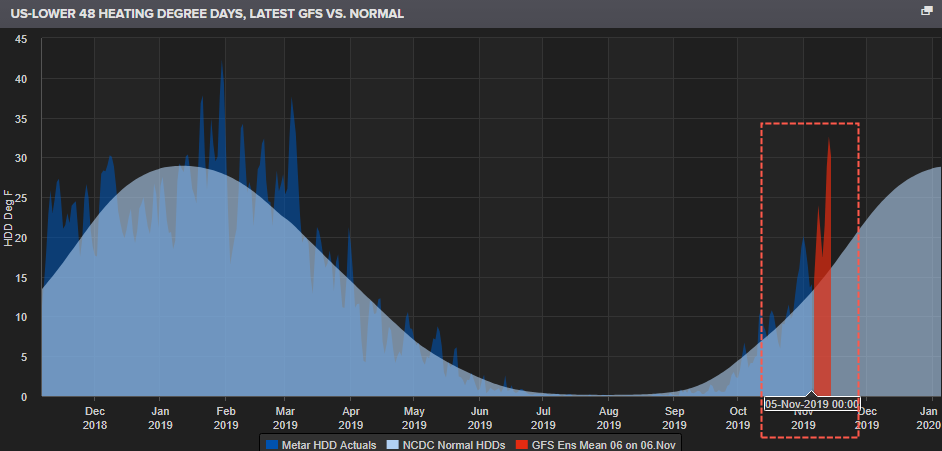
The Lower Contiguous 48 States heating degree day (HDD), an index designed to quantify the demand for energy needed to heat a structure, certainly shows that energy usage is already surging as colder weather rolls into parts of the Midwest, Central, Mid-Atlantic and Northeast regions.
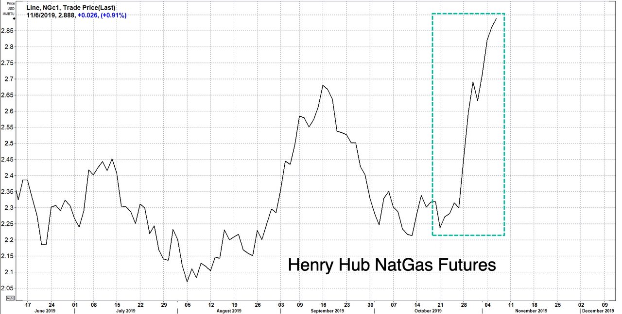
Henry Hub Natural Gas Futures in the last 18 sessions have jumped more than 30% on weather forecasts detailing the upcoming winter blast.
https://www.zerohedge.com/commoditie...nter-northeast


 Reply With Quote